Mystery map recovered from basement


A HUGE old map of Shetland’s southernmost coastline has been found in the basement of a historic house in Sandwick.
Property manager Robert Bell discovered the map measuring five by 15 feet last year in his cellar at Sand Lodge, whose estate used to incorporate the Sumburgh coastline that is depicted.
Local archivist identified the map had been drawn by well known teacher, surveyor and prolific map maker Andrew Dishington Mathewson from East Yell in 1873.
Smith said the clue was in the “cartouche” at the top of the map, which was in Mathewson’s distinctive style.
However some mystery surrounds the drawing, as it is so large but contains relatively little information beyond the shape of the Sumburgh coastline, the main road from Virkie to Grutness and the Sumburgh lighthouse.
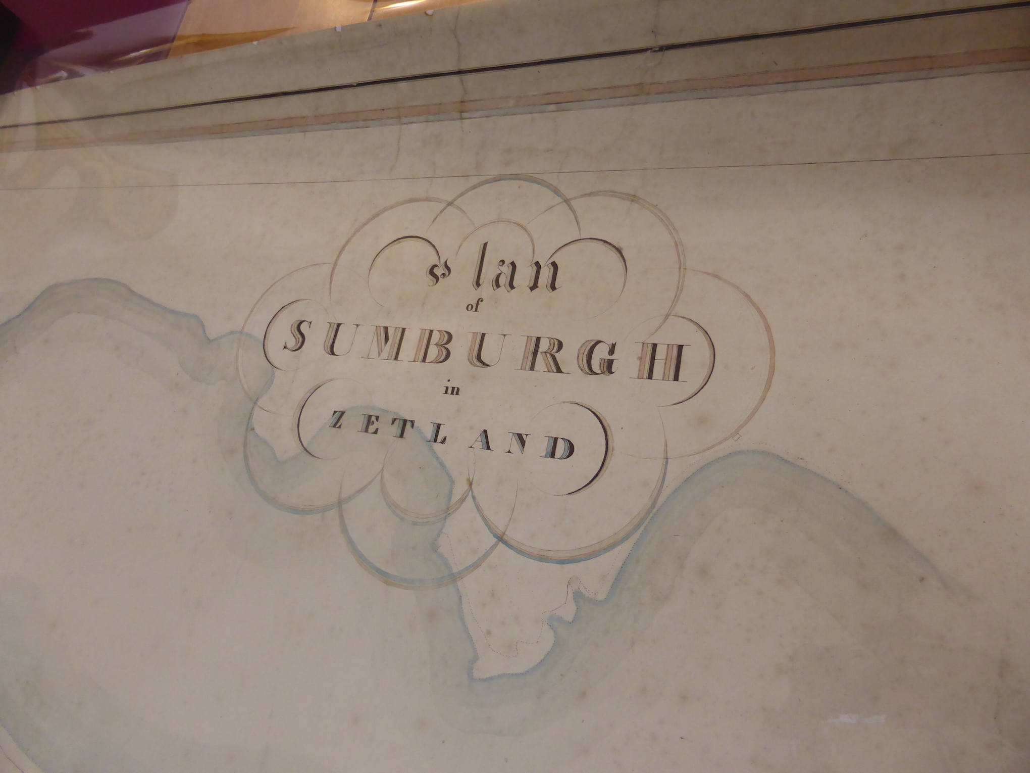
“The map was presumably commissioned by John Bruce Senior of Sumburgh, who may have wanted a nice big map of his main property to hang up in his house,” Smith said, adding that it appeared the work was never finished.
While many of Mathewson’s maps were highly detailed, this one lacks names and much details on the buildings it displays.
The map was donated to Shetland Archives who handed it to the Carronvale Bindery in Falkirk for conservation.
Keep Shetland’s news open to everyone
Your membership helps us report the stories that matter to Shetland — and keep them free for everyone to read.